
Enjoy living well while safeguarding the future
Route L7 – Checkley, Knighton & Norton in Hales (21 miles-harder)
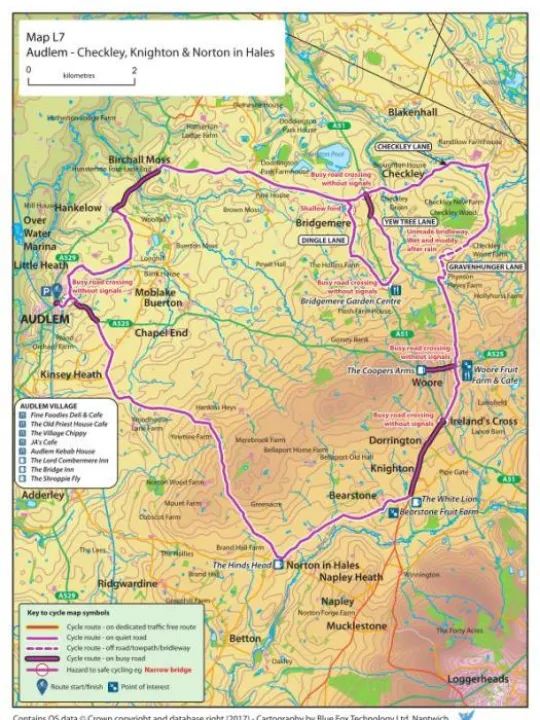
A grand circular tour to the east of Audlem, packed with interest (picturesque countryside, views, a bridleway, a ford and more!)
- The route follows back roads and 'B roads' but a short 0.8 mile section of the busy A529 is involved from Hankelow northwards. Alternatively, this section has a good footway which can be walked with cycles, but cycling on it is not permitted.
- The route follows a bridleway to the north east of Woore, which links Checkley Lane to Gravenhunger Lane.
- The bridleway section at Gravenhunger Lane has a muddy and slippery section of track which can be very wet after rain. Be prepared for lying water on this section unless conditions are very dry. The route is not recommended in winter conditions after prolonged rain.
- The main road crossings of the A51 (twice) and the A525 (twice) require care.
- There is a fairly lengthy climb of moderate gradient to the north of Norton in Hales. However, it's worth the effort as the views from the summit can be stunning.
- There is a pretty detour as an alternative to the main route by way of Dingle Lane and Yew Tree Lane. This route passes the boundary of Bridgemere Garden Centre. This involves a short section of the A51, where great care should be taken. Also, Dingle Lane has a ford through which care should be taken and brakes tested afterwards. The ford should not be attempted if fast flowing.
Refreshments
The Hinds Head, Norton in Hales
The White Lion, Knighton
Chetwode Arms, Pipe Gate. (A short detour from the direct route is involved. Use of lanes marked on map is recommended rather than the busy A51)
A slight detour to Woore gives access to The Coopers Arms and The Falcon Inn.
Woore Fruit Farm Cafe.
The detour via Dingle Lane and Yew Tree Lane gives access to Bridgemere Garden Centre cafes.