
Enjoy living well while safeguarding the future
Route L5 – Aston, Sound & Hack Green (14 miles-easy / harder)
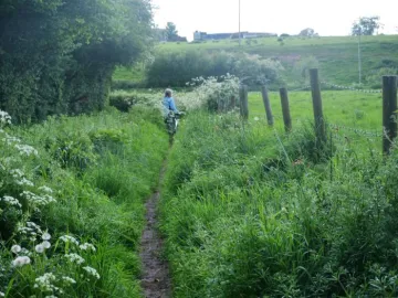
A fairly short rural circular route to the north-west of Audlem on largely quiet back lanes. There are short sections of moderate gradient either side of the bridge over the Weaver, but otherwise the route is largely flat.
Route L5 (14.7 miles-easy)
- A 1 mile section of the A525 Whitchurch Road to Coole Lane is involved in the exit and return to Audlem. This is a busy main road requiring caution, especially around the narrow bridge crossing the River Weaver.
- The two crossings of the main A530 at Aston and Sound require care.
Route L5* (13.5 miles-harder)
- As an alternative to the all on-road route, there is the (harder) option to shorten the route by use of Woodcotthill Lane which links Aston with Wrenbury Heath. This lane is a mixture of metalled roadway and unmade track, with a deep ford in the middle. Do not cycle through the deep ford, but instead dismount and walk your cycle round the footpath and causeway on the east side of the ford. Cycling is not permitted on the footpath and care should be taken in walking with a cycle as the path is narrow and on a steep bank. The south end of the path can be muddy and slippery after rain and use of this alternative route is not recommended when river levels are high. To the north of the ford, the track is fairly steep.
Places of interest
The Secret Bunker, Hack Green (Admission charges apply)
Refreshments
The Bhurtpore Inn, Aston
The Park Coffee Shop, Wrenbury
The Cafe at Bridge 80
